Search This Blog

Tuesday, August 10, 2021

History Of Dubbo - New South Wales

Aboriginal and Torres Strait Islander readers are advised that this page contains the names and images of people who have died.

Dubbo sits on the Macquarie River, the Wambuul, out on the edge of the western plains, about 400 kilometres from Sydney by road. It's Wiradjuri country. Europeans first came through with John Oxley in 1818, a squatter named Robert Dulhunty took up a run there in the early 1830s, and by 1849 a little bush settlement with a lock-up, a store and an inn had been gazetted as a village. From there it grew into a municipality in 1872, got the railway in 1881, became a city in 1966 and now draws people from all over to its gaol, its old slab homestead and its big open-range zoo. Below is my original post, followed by the longer story.

The History Of Dubbo - New South Wales


Dubbo - New South Wales

Dubbo is a city located in the Orana region of New South Wales, Australia.

1. Indigenous History: The Dubbo region has a long history of human occupation by the Wiradjuri people, who are the traditional custodians of the land. They have lived in the area for thousands of years and have a rich cultural heritage.

2. European Settlement: European exploration of the Dubbo area began in the early 19th century. In 1818, John Oxley, an explorer and surveyor, visited the area. The river nearby had already been named the Macquarie River after Governor Lachlan Macquarie by George Evans in 1812-13.

3. Establishment of Dubbo: Dubbo was gazetted as a village in November 1849. Storekeeper Jean Emile Serisier had organised a petition in 1848 for a sale of town allotments, and surveyor G. Boyle White's plan for the township on the banks of the Macquarie River was presented to the Surveyor General in May 1849. The name Dubbo comes from the Wiradjuri language (Dhubu, thought to come from the word thubbo).

4. Growth and Development: Dubbo grew steadily, benefiting from its strategic location as a crossing point on the Macquarie River and along major stock routes. It served as an important center for pastoralists, gold miners, and those seeking new opportunities in the expanding western regions of New South Wales.

5. Infrastructure and Services: Over time, Dubbo developed essential infrastructure and services. On 1 February 1881, the railway line reached the town, connecting it to Sydney and facilitating transportation of goods and people. The town also established educational institutions, hospitals, and other amenities.

6. Economic Activities: The local economy of Dubbo has been predominantly based on agriculture, particularly sheep and cattle farming. The region is known for its agricultural productivity, including wheat, wool, cotton, and other crops.

7. Cultural Heritage: The Wiradjuri people have a significant presence in Dubbo, and their cultural heritage is celebrated and respected.

8. Tourism: Dubbo has become a popular tourist destination, attracting visitors with its attractions such as the Taronga Western Plains Zoo, the Old Dubbo Gaol (a former prison turned museum), and various outdoor recreational activities.

Today, Dubbo is a thriving regional center, serving as a hub for commerce, education, health services, and tourism. It continues to grow and evolve while preserving its historical and cultural significance.

The Longer Story of Dubbo

Wiradjuri Country and the Name "Dubbo"

Long before any surveyor turned up, this was Wiradjuri land. Wikipedia's Dubbo article says evidence of Wiradjuri habitation goes back more than 40,000 years. The Wiradjuri are one of the biggest Aboriginal nations in New South Wales, and the river through town carries its Wiradjuri name, Wambuul, alongside the English one.

Nobody is completely sure what "Dubbo" means, and it's worth being honest about that. The Wiradjuri spelling is given as Dhubu. The usual view is that "Dubbo" is a mispronunciation of a Wiradjuri word, thubbo. Because Dulhunty didn't leave precise records, and today's knowledge of the language is incomplete, there's more than one story. Some say the word meant "red soil", which fits the red earth around town. Others say thubbo or tubbo meant "head covering". A third version says Dubbo was the name of an old Wiradjuri man who was living at the spot when Dulhunty took up the land.

The Macquarie River, Wambuul, as it runs through Dubbo, April 2026
The Macquarie River, Wambuul, as it runs through Dubbo, April 2026. SnowyRiver28, CC BY-SA 4.0, via Wikimedia Commons
Another view of the Wambuul at Dubbo, April 2026
Another view of the Wambuul at Dubbo, April 2026. SnowyRiver28, CC BY-SA 4.0, via Wikimedia Commons

Oxley Comes Down the Macquarie, 1818

The river had already been named by the time Oxley got there. George Evans, the deputy surveyor, came across its upper reaches near Bathurst in 1812–13 and named it after Governor Lachlan Macquarie. In 1817 and 1818 John Oxley was sent off to trace the Lachlan and then the Macquarie, and he's recorded as the first European to report on the country that's now Dubbo, in 1818.

Oxley's journal, published in 1820, describes the river below Wellington with "rich flats on either side", long reaches "literally covered with water-fowl", and a current you could barely see. He followed it down until it spread out into an "ocean of reeds" in what we now call the Macquarie Marshes. That convinced him he was close to an inland sea. He was wrong about the sea, but his reports of good grazing country were what brought the squatters.

Portrait of John Oxley, 1810, watercolour held by the State Library of New South Wales
Portrait of John Oxley, 1810, watercolour held by the State Library of New South Wales. Unknown artist, Public domain, via Wikimedia Commons
Oxley's chart of part of the interior of New South Wales, showing the Lachlan and Macquarie country
Oxley's chart of part of the interior of New South Wales, showing the Lachlan and Macquarie country. John Oxley; engraved by A. Arrowsmith, Public domain, via Wikimedia Commons

Robert Dulhunty and Dubbo Station

Robert Venour Dulhunty was born in Paignton, Devon, in 1803 and arrived in Sydney as a free settler on the Guildford on 5 March 1824, with his brother Lawrence. He got a 2,000-acre grant at Cullen Bullen and later lived mostly at Claremont in the Mulgoa Valley near Penrith.

Sometime between 1829 and 1833 he set out from Penrith with about 40 Aboriginal people in his party, crossed the mountains and followed the Macquarie down to Dubbo. When surveyor Robert Dixon passed through in 1833 to survey the Bogan, he noted he'd borrowed a dray from Dulhunty, so it's believed Dulhunty took up the land in about 1832. He liked using Aboriginal names for his properties, and "Dubbo" was one of them. After the Squatting Act of 1836 he took out a licence for Dubbo Station, in 1837.

By 1839 he had 28 free men and 18 assigned convicts working at Dubbo. His Wikipedia biography says he had a name as a fair boss who seldom had his convicts flogged. He hit his peak around 1839–40 with half a dozen big runs, then the depression of the early 1840s cost him dearly. He moved his family permanently to Dubbo in 1847 and died on 30 December 1853.

A Lock-up, a Store and an Inn: The 1849 Village

By 1846 there were enough settlers about that the government decided Dubbo needed a courthouse, police station and lock-up. A constable's residence went up in 1847, and a wooden slab courthouse and lock-up were finished early in 1848. That was the whole of Dubbo then, four buildings: the constable's house, the courthouse and lock-up, a store and an inn.

Nobody had title to their land, so in 1848 the storekeeper, Jean Emile Serisier, got a petition going asking for a sale of town allotments. Surveyor G. Boyle White sent a plan to the Surveyor General in May 1849, the place was gazetted as a village in November 1849, and the first land sales were held in 1850.

Dubbo Court House, about 1881
Dubbo Court House, about 1881. State Records NSW (Photographic Collection from Australia), CC BY 2.0, via Wikimedia Commons
Dubbo Court House in 1889
Dubbo Court House in 1889. State Records NSW (Photographic Collection from Australia), CC BY 2.0, via Wikimedia Commons

Gold, Trade and the Roads North and South

Growth was slow at first. According to Wikipedia's Dubbo article, it was the gold rush trade of the 1860s, with traffic moving north and south through town, that really got things going. The first bank opened in 1867. By 1872 there were 850 people, and Dubbo was proclaimed a municipality that year.

Dubbo became a law-and-order centre for a huge stretch of the west. The heritage listing for the gaol makes the point that it was a regional centre for the courts before it became a place for commerce and settlement. The courthouse that stands today was built in 1887, and Kgbo's photo of the gate shows the date 1888.

The Dubbo Courthouse in November 2007
The Dubbo Courthouse in November 2007. Michael Gardner (MichaelGG), Public domain, via Wikimedia Commons
The date 1888 on the gate of the Dubbo Court House
The date 1888 on the gate of the Dubbo Court House. Kgbo, CC BY-SA 4.0, via Wikimedia Commons
Macquarie Street, Dubbo, in the 1920s
Macquarie Street, Dubbo, in the 1920s. State Records NSW (Photographic Collection from Australia), CC BY 2.0, via Wikimedia Commons

Old Dubbo Gaol

The gaol in Macquarie Street grew up on the site of the town's very first courthouse. The NSW State Heritage Register record, summarised on Wikipedia, gives a long list of building dates. A new stone lock-up in 1871 was the start of the gaol proper. A hospital, kitchen block, perimeter wall and watchtowers followed between 1877 and 1880, and big alterations, including the women's cells, came in 1886–87. It's believed to have been officially opened as a gaol in 1887. Inside the walls are 12 ordinary cells plus solitary cells, a padded cell and a condemned cell, and the gallows have been re-erected.

The gaol closed in 1966. The state government planned to knock it down for an office block, but Dubbo City Council and the local historical society fought it. In 1973 it was handed to the council, and it opened as a tourist attraction in 1974. It was added to the State Heritage Register on 26 March 2004.

Old Dubbo Gaol, 2021
Old Dubbo Gaol, 2021. Kgbo, CC BY-SA 4.0, via Wikimedia Commons
Inside Old Dubbo Gaol, 2021
Inside Old Dubbo Gaol, 2021. Kgbo, CC BY-SA 4.0, via Wikimedia Commons
Old Dubbo Gaol, 2021
Old Dubbo Gaol, 2021. Kgbo, CC BY-SA 4.0, via Wikimedia Commons
Old Dubbo Gaol, 2022
Old Dubbo Gaol, 2022. Kgbo, CC BY-SA 4.0, via Wikimedia Commons
The gaol entrance on Macquarie Street, 2007
The gaol entrance on Macquarie Street, 2007. Sheba_Also 43,000 photos, CC BY-SA 2.0, via Wikimedia Commons
State Heritage Register plan of Old Dubbo Gaol
State Heritage Register plan of Old Dubbo Gaol. Heritage Division, CC BY 4.0, via Wikimedia Commons

Jacky Underwood and the Breelong Murders

The best-known name tied to the gaol is Jack (Jacky) Underwood. On the night of 20 July 1900, Jimmy Governor, his brother Joe and Underwood attacked the Mawbey family's homestead at Breelong near Gilgandra, killing members of the family and the schoolteacher Ellen Kerz. Underwood split from the Governor brothers and was caught on 24 July at William Shaw's selection near Leadville, where he'd called in claiming to be "Charlie Brown".

He was tried at Dubbo on 2 October 1900 before Judge G. B. Simpson for the murder of Percy Mawbey. The jury found him guilty, though it told the court it couldn't decide who had struck the fatal blows. He was sentenced to death, waited months in the cell at Dubbo Gaol, and was hanged there on 14 January 1901. Jimmy Governor was caught near Wingham, tried in Sydney and hanged at Darlinghurst Gaol in January 1901. Joe Governor was shot dead north of Singleton. I've told the full story in my Jimmy Governor and Gilgandra page.

Jack Underwood, photographed after his capture in July 1900
Jack Underwood, photographed after his capture in July 1900. Unknown author, Public domain, via Wikimedia Commons
Jacky Underwood with police after his capture, published in the Daily Telegraph, 30 July 1900
Jacky Underwood with police after his capture, published in the Daily Telegraph, 30 July 1900. Unknown author, Public domain, via Wikimedia Commons
Jimmy Governor, 1900
Jimmy Governor, 1900. Unknown author, Public domain, via Wikimedia Commons
A mounted posse during the hunt for the Governor brothers, 1900
A mounted posse during the hunt for the Governor brothers, 1900. State Library of New South Wales collection, no known copyright restrictions, via Wikimedia Commons

The Railway Arrives, 1881

The Main Western line was extended from Wellington and formally opened to Dubbo on 1 February 1881. Most of the stone station buildings went up between 1879 and 1881 under John Whitton, the railways' Engineer-in-Chief. The station building is a stone "first class" type with a refreshment room, and a stone station master's house in Talbragar Street was finished the same year.

Dubbo became a proper railway town, with a junction for the Main Western, Molong–Dubbo and Coonamble lines and a big loco depot. It was as far west as the heavy 36, 38 and 60 class engines went; smaller locos took over beyond. The last piece of the Molong to Dubbo line opened in May 1925, and that line was decommissioned in 1988. Trains from Sydney still finish at Dubbo, with coaches carrying on to Bourke, Broken Hill, Lightning Ridge and other towns.

Dubbo Railway Station, from the State Heritage Register listing
Dubbo Railway Station, from the State Heritage Register listing. B. Hanna, CC BY 4.0, via Wikimedia Commons
Dubbo railway station in 2017
Dubbo railway station in 2017. Bahnfrend, CC BY-SA 4.0, via Wikimedia Commons
The Station Master's House at Dubbo
The Station Master's House at Dubbo. B. Hanna, CC BY 4.0, via Wikimedia Commons
Dubbo waiting for the royal visit, 10 February 1954
Dubbo waiting for the royal visit, 10 February 1954. State Records NSW (Photographic Collection from Australia), CC BY 2.0, via Wikimedia Commons

Dundullimal Homestead

About 7 kilometres south of town on Obley Road, just past the zoo, is Dundullimal, built by John Maughan on his sheep run beside the Macquarie. It's believed to be the oldest surviving slab hut house in Australia. The National Trust owns it, and it went on the State Heritage Register on 1 March 2002. The run sat in the old Wellington Squatting District, beyond Governor Darling's "limits of location", where squatters took up land under the 1836 licences.

The entrance to Dundullimal Homestead
The entrance to Dundullimal Homestead. Bidgee, CC BY-SA 3.0, via Wikimedia Commons
The stables at Dundullimal Homestead, 2021
The stables at Dundullimal Homestead, 2021. Kgbo, CC BY-SA 4.0, via Wikimedia Commons
An old wool press in the stables at Dundullimal, 2021
An old wool press in the stables at Dundullimal, 2021. Kgbo, CC BY-SA 4.0, via Wikimedia Commons

The River and Its Floods

The Macquarie has always been both Dubbo's reason for being and its biggest worry. Oxley noticed it in 1818, writing about "the vast body of water which this river must contain in times of flood". The river's recorded flood history includes serious flooding in 1955 and heavy flooding of low-lying land along the river in 1979. In November and December 2010 there was major flooding on the lower Macquarie. Burrendong Dam near Wellington now holds back the river for flood control and irrigation.

Dubbo in the Second World War

When war came, the RAAF wanted its supply depots well inland, out of reach of carrier-borne aircraft. Sites across inland NSW were surveyed in February 1942, and in April Dubbo was chosen. The RAAF Stores Depot in Cobra Street was built between 1940 and 1943. It was one of ten RAAF stores depots in Australia and one of only two in NSW, and it carried on under various names until 1995. In the 1930s Depression that same ground had been "Bagtown", where families camped in makeshift tents. The land that later became the zoo was also an army camp during the war.

The wrought iron gates of the Memorial Park, Dubbo, each with the Rising Sun badge
The wrought iron gates of the Memorial Park, Dubbo, each with the Rising Sun badge. Doug butler, CC BY-SA 4.0, via Wikimedia Commons
Jacarandas in flower along the avenue of the Memorial Park, Dubbo
Jacarandas in flower along the avenue of the Memorial Park, Dubbo. Doug butler, CC BY-SA 4.0, via Wikimedia Commons

A City, 1966

Dubbo was officially proclaimed a city in 1966, the same year the gaol closed. The town's older streets still show its story: the Victorian courthouse, the Lands Office clad in timber and corrugated iron, the 1881 station, red-brick California bungalows and Victorian terraces around Darling Street.

The Dubbo swimming pool, undated photo from State Records NSW
The Dubbo swimming pool, undated photo from State Records NSW. State Records NSW (Photographic Collection from Australia), CC BY 2.0, via Wikimedia Commons
Macquarie Street, the main street of Dubbo, 2017
Macquarie Street, the main street of Dubbo, 2017. Bahnfrend, CC BY-SA 4.0, via Wikimedia Commons

Western Plains Zoo, 1977

In the late 1960s plans were drawn up for a big plains zoo to go with Sydney's Taronga, a place where large grazing animals could breed and roam in the open. The old wartime army camp outside Dubbo was turned into a 300-hectare zoo of bush and irrigated grassland, and Western Plains Zoo opened on 28 February 1977. Its Wikipedia article says it opened with 35 different animals from six countries and was the first new zoo built in Australia in 60 years. There are no fences in sight, just hidden moats. Today it's Taronga Western Plains Zoo, known for its rhinos and breeding programs for endangered species. Its story ties back to Sydney's old Moore Park zoo and to Taronga, which I've written about separately.

Taronga Western Plains Zoo, 2020
Taronga Western Plains Zoo, 2020. Maksym Kozlenko, CC BY-SA 4.0, via Wikimedia Commons
The entrance to Western Plains Zoo
The entrance to Western Plains Zoo. Ché Lydia Xyang, CC BY-SA 3.0, via Wikimedia Commons
The giraffe enclosure at Western Plains Zoo
The giraffe enclosure at Western Plains Zoo. Ché Lydia Xyang, CC BY-SA 3.0, via Wikimedia Commons

Dubbo Today

At the 2021 Census Dubbo had 43,516 people, the largest centre in the Orana region, and 15.6 per cent of residents were Aboriginal or Torres Strait Islander. It sits where the Newell, Mitchell and Golden highways cross. It's the big shopping, hospital and freight town for much of the west, with a Charles Sturt University campus, a Royal Flying Doctor Service base at the airport, and Fletcher International Exports as its largest private employer.

Dubbo town centre, 2020
Dubbo town centre, 2020. Maksym Kozlenko, CC BY-SA 4.0, via Wikimedia Commons

Timeline

  • 40,000+ years ago: Evidence of Wiradjuri habitation in the Dubbo area.
  • 1812–13: George Evans reaches the upper Macquarie and names it after Governor Macquarie.
  • 1818: John Oxley comes down the Macquarie and reports on the Dubbo country.
  • c.1832: Robert Dulhunty takes up the land he calls "Dubbo" (some sources say 1828).
  • 1837: Dulhunty takes out a licence for Dubbo Station.
  • c.1840–42: John Maughan builds Dundullimal.
  • 1847–48: Constable's residence, then a slab courthouse and lock-up, are built.
  • 1848: Storekeeper J. E. Serisier petitions for a sale of town allotments.
  • November 1849: Dubbo is gazetted as a village.
  • 1850: First land sales.
  • 30 December 1853: Robert Dulhunty dies.
  • 1867: First bank opens.
  • 1871: New stone lock-up built, the start of Dubbo Gaol.
  • 1872: Dubbo proclaimed a municipality, population 850.
  • 1 February 1881: The railway from Wellington formally opens.
  • 1887: The present courthouse is built and the gaol is believed to have been officially opened.
  • 2 October 1900: Jacky Underwood is tried at Dubbo.
  • 14 January 1901: Underwood is hanged at Dubbo Gaol.
  • May 1925: The Molong to Dubbo line is completed.
  • April 1942: Dubbo is chosen for an RAAF stores depot.
  • 1955: Serious flooding of the Macquarie.
  • 1966: Dubbo becomes a city, and the gaol closes.
  • 1974: Old Dubbo Gaol reopens as a tourist attraction.
  • 28 February 1977: Western Plains Zoo opens.
  • 1979: Heavy flooding along the river.
  • 2002 and 2004: Dundullimal and the gaol are added to the State Heritage Register.

Where the Sources Disagree

  • When Dulhunty arrived: Wikipedia's Dubbo article says Dubbo Station was "established in 1828" and occupied from the early 1830s. Wikipedia's Robert Dulhunty article puts his trek at sometime between 1829 and 1833, and says he probably took up the land in 1832.
  • Dundullimal's date and builder: The Dubbo article says it was built "around 1840" by "John Maugham". The Dundullimal Homestead article, drawing on the heritage listing, says "c. 1842" by "John Maughan".
  • The name "Dubbo": Sources give "red soil", "head covering", and the name of an old Wiradjuri man. None can be proved, because Dulhunty left no clear record.
  • When the gaol began: The heritage record treats the 1871 stone lock-up as the start of Dubbo Gaol, but the gaol is "believed" to have been officially opened in 1887. The same record says it was built "from 1847 to 1945", counting the first lock-up and the last additions.
  • Gold and growth: Wikipedia credits "the Victorian gold rush of the 1860s" for Dubbo's growth. The main Victorian rush began in the 1850s, so the 1860s trade may have had more to do with the New South Wales goldfields. I couldn't settle this from the sources I fetched.

My Earlier Posts

Sources

  • Wikipedia, "Dubbo" – https://en.wikipedia.org/wiki/Dubbo
  • Wikipedia, "Old Dubbo Gaol" (based on the NSW State Heritage Register listing) – https://en.wikipedia.org/wiki/Old_Dubbo_Gaol
  • Wikipedia, "Dundullimal Homestead" (based on the NSW State Heritage Register listing) – https://en.wikipedia.org/wiki/Dundullimal_Homestead
  • Wikipedia, "Robert Dulhunty" – https://en.wikipedia.org/wiki/Robert_Dulhunty
  • Wikipedia, "Jimmy Governor" – https://en.wikipedia.org/wiki/Jimmy_Governor
  • Wikipedia, "Dubbo railway station" – https://en.wikipedia.org/wiki/Dubbo_railway_station
  • Wikipedia, "Macquarie River" (including Oxley's 1820 journal extract and the flood list) – https://en.wikipedia.org/wiki/Macquarie_River
  • Wikipedia, "Dubbo RAAF Stores Depot" – https://en.wikipedia.org/wiki/Dubbo_RAAF_Stores_Depot
  • Wikipedia, "Taronga Western Plains Zoo" – https://en.wikipedia.org/wiki/Taronga_Western_Plains_Zoo
  • Wikipedia, "Wiradjuri" – https://en.wikipedia.org/wiki/Wiradjuri
  • Images: Wikimedia Commons, credited under each picture.

Albert The Good Statue - Queens Square - Hyde Park Barracks Vicinity - Macquarie Street - Sydney - NSW


Albert The Good Statue - Queens Square - Hyde Park Barracks Vicinity - Macquarie Street - Sydney - NSW


This statue of Albert the Good by English sculptor William Theed (1804-91) stands in Queens Square however, when it was first unveiled by the Governor Sir John Young in April 1866, it was located at the entrance to Hyde Park. Albert the Good was the Prince Consort, the husband of Queen Victoria. In 1922 the statue was moved, during the works for the City Circle railway, possibly to the Royal Botanic Garden, according to the City of Sydney. In 1987 it was returned to its present spot in front of Hyde Park Barracks, opposite the statue of Queen Victoria.


Prince Albert Road

Forming the eastern half of the semi-circle of road at the northern end of Hyde Park, Prince Albert Road serves no particular purpose than to provide balance and contrast to St James Road. Its name seems appropriate, given that it honours Albert the Good, the German born Consort and husband of Queen Victoria, who many believe served no particular regal purpose than to provide balance and contrast to Queen Victoria. The connection between Queen Victoria and Prince Albert accounts for the naming of Prince Albert Road, given its relationship with Queens Square. His formal title was Prince Consort, granted by Queen Victoria in 1857. There would have been some concern over the Queen marrying a foreigner, and the name "Albert the Good" would have been part of Royal propaganda to winning the people around with the assurance that he was a real good fellow.


Prince Albert never visited Australia and was little known in this country except for his straight-laced moral attitude, his devotion to his wife and her deep love for him. He was the mastermind of the Crystal Palace exhibition of 1851 which triggered a succession of imitative expositions around the British Empire including one in Sydney and another in Melbourne. He contracted typhoid fever and died shortly before Christmas 1861. Prince Albert's death devastated Queen Victoria who suffered a nervous breakdown. Tradition has it that for the rest of her life she slept with a photo above her head, taken of him as he lay dead, and had his clothes laid out on the bed. The basin in his room was filled with fresh water every day until her death.


Albert the Good – The Full Story of Sydney's Prince Consort Statue

Walk up Macquarie Street to the top end, where it meets Prince Albert Road and St James Road, and you'll find two bronze figures eyeing each other across the traffic. On the western side is Queen Victoria. On the eastern side, out the front of Hyde Park Barracks, is her husband Prince Albert, robed up in the Order of the Garter. He's been standing in Sydney since St George's Day, 23 April 1866, when somewhere between twenty and thirty thousand people turned out to watch him unveiled. Since then he has been shifted off his first spot at the top of Hyde Park, spent decades out of the way, and was only put back next to his Queen in 1987. Here's how it all happened.

Bronze statue of Prince Albert in Queens Square, Sydney
Albert the Good in Queens Square in 2021, out the front of Hyde Park Barracks. Kgbo, CC BY-SA 4.0, via Wikimedia Commons

Who Was Prince Albert?

Prince Albert of Saxe-Coburg and Gotha was born on 26 August 1819 at Schloss Rosenau, near Coburg in Germany. He married his first cousin, Queen Victoria, on 10 February 1840 at the Chapel Royal, St James's Palace, and they went on to have nine children. Victoria formally gave him the title "Prince Consort" in 1857.

He wasn't popular with the British at first. Wikipedia's account of his life notes he was seen as coming from a poor little German state, and that Parliament's refusal to make him a peer was partly down to anti-German feeling. Over time he won people over. He backed educational reform and the fight against slavery, ran the royal household and estates, and above all pushed through the Great Exhibition of 1851 in the Crystal Palace in London's Hyde Park. The profit from that show bought the land in South Kensington where the Natural History Museum, the Science Museum, the Royal Albert Hall and the Victoria and Albert Museum now stand.

Photograph of Prince Albert, 1860
Prince Albert photographed by J.J.E. Mayall on 15 May 1860, about eighteen months before he died. John Jabez Edwin Mayall, Public domain, via Wikimedia Commons
Winterhalter portrait of Prince Albert, 1859
Prince Albert painted by Franz Xaver Winterhalter in 1859. Franz Xaver Winterhalter, Public domain, via Wikimedia Commons
The Crystal Palace, 1851
The Crystal Palace during the Great Exhibition of 1851, Albert's great project. Dickinson Brothers, Public domain, via Wikimedia Commons

His Death in December 1861

Albert had been poorly for a couple of years with stomach trouble. On 9 December 1861 one of his doctors, William Jenner, diagnosed typhoid fever, and Albert died in the Blue Room at Windsor Castle at 10.50 pm on 14 December 1861. He was only 42. Some modern writers think a long-running illness such as Crohn's disease, kidney failure or cancer may have been the real cause, given how long he had been sick.

Victoria never got over it. She went into deep mourning and wore black for the rest of her life, and Albert's rooms in all their houses were kept as he left them, with hot water brought in each morning and fresh linen and towels laid out every day. Albert had asked that no statues be put up to him, but nobody listened. Memorials went up right across Britain and the Empire, so many that Charles Dickens joked to a friend that he was looking for an "inaccessible cave" to get away from them.

Engraving of the death of Prince Albert
"The last moments of H.R.H. the Prince Consort", a print of the scene at Windsor in December 1861. Unknown author, CC BY 4.0, via Wikimedia Commons
The Albert Memorial in Kensington Gardens, London
The best known of all the memorials, the Albert Memorial in Kensington Gardens, London. Diliff, CC BY-SA 3.0, via Wikimedia Commons

Sydney Passes the Hat Around

When the news of Albert's death reached the colony, Sydney decided it wanted its own statue. According to the City of Sydney, a Prince Consort's Statue Association was set up to raise the money, chaired by Edward Deas Thomson, the former Colonial Secretary and a member of the Legislative Council. The plan was paid for by public subscription.

The money didn't exactly pour in. The City of Sydney says the public's response was "perhaps more equivocal" than the committee's enthusiasm, and quotes the Illustrated Sydney News of 16 May 1866 saying that "a temporary want of funds" meant the statue was barely ready in time for its big day. The Empire newspaper of 23 May 1866, quoted on Monument Australia, put the sum needed at about £3,000, which was sent off to England.

Portrait of Edward Deas Thomson
Edward Deas Thomson, drawn by William Nicholas in the late 1840s. He later chaired the Prince Consort's Statue Association. William Nicholas, Public domain, via Wikimedia Commons

The Sculptor – William Theed the Younger

The statue was the work of William Theed the younger (1804–1891), who was born in Trentham, Staffordshire. He trained at the Royal Academy Schools, spent nearly twenty years working in Rome, and came back to London in 1848. He did a lot of work for the royal family, and after Albert died Queen Victoria had Theed take the prince's death mask. He went on to make several memorial statues of Albert, including the one at Balmoral Castle.

The Empire's 1866 report says the Sydney bronze was "the second of the Prince", designed by "Mr. W. Theed, Henrietta-street, Cavendish-square, London", and cast at Nuremberg. It was put on show in London in March 1865. The paper says the original model had been made at the Queen's command as a present to Coburg, and that the Duke of Newcastle ordered a bronze cast taken from it for the people of Sydney. It also says the Queen thought this the best likeness of Albert there was.

Unveiling Day – St George's Day, 23 April 1866

On the day, the Empire reported, the statue was "uncovered on St. George's Day" at the northern entrance to Hyde Park, opposite Macquarie Street, with "his Excellency the Governor" there to give an address (that was Sir John Young, as my original text says). The paper called the crowd "the largest assemblage of citizens of all classes ever witnessed in Sydney", with estimates of twenty to thirty thousand people. The City of Sydney, quoting the Illustrated Sydney News, says the streets were packed from early in the morning.

The Empire described the figure as ten feet high, showing the prince "in a commanding attitude dressed in the robes of the order of the garter". The railings were the "universal trident" pattern used at the Great Exhibition of 1851, and the oval base, 20 feet by 16, was of colonial stone with spots left on which it was "intended to place lions". The whole thing, statue and pedestal, stood 20 feet 6 inches. The City of Sydney adds that in his left hand he holds a sceptre and in his right an unrolled scroll.

Prince Albert statue in Hyde Park, 1872
Prince Albert's statue at the top of Hyde Park in 1872, photographed by Charles Percy Pickering for the Government Printing Office. Pickering, Charles Percy (New South Wales. Government Printing Office), Public domain, via Wikimedia Commons
Prince Albert statue at the northern entrance to Hyde Park, about 1880
Albert at the northern entrance to Hyde Park around 1880. Australian National Maritime Museum on The Commons, No known copyright restrictions, via Wikimedia Commons
Hyde Park viewed from Queens Square, about 1889
Hyde Park from Queens Square, about 1888–1890, by Charles Bayliss. Albert's first spot was here at the head of the park's main avenue. Charles Bayliss, Public domain, via Wikimedia Commons

The Inscription

The words on the pedestal read:

THE PEOPLE OF NEW SOUTH WALES TO ALBERT THE GOOD PRINCE CONSORT OF QUEEN VICTORIA 1866

So "Albert the Good" isn't just a nickname. It's carved right there in the stone.

Prince Albert statue and pedestal, Sydney
The statue and its pedestal, photographed in 2017. Kgbo, CC BY-SA 4.0, via Wikimedia Commons
Close view of the Prince Albert statue, Sydney
Albert in his Garter robes, sceptre in one hand and scroll in the other. Kgbo, CC BY-SA 4.0, via Wikimedia Commons

Queen Victoria Joins Him – 1888

For more than twenty years Albert stood on his own. Then, for the centenary in 1888, a statue of Victoria went up across the way in Queens Square. Governor Macquarie had planned a public square there. It was first called Kings Square and was renamed Queens Square when Victoria came to the throne in 1837.

The Queen's statue is by Joseph Edgar Boehm. The Yale Center for British Art says it was commissioned for her Golden Jubilee of 1887 and that a foundation stone had gone down as early as 1881, during the visit of Prince Edward and Prince George of Wales. Lord Carrington, the Governor, unveiled it on 24 January 1888, two days before the centenary itself. Yale puts the crowd at over fifty thousand. When Victoria died in 1901 the statue became a focus for Sydney's mourning, and for years afterwards it was dressed up for Empire Day.

Crowds at Queens Square, 1888
Celebrations at Queens Square, dated 24 January 1888, the day the Queen Victoria statue was unveiled. From State Archives and Records NSW. Photographic Collection from Australia, CC BY 2.0, via Wikimedia Commons
Queens Square with St James Church and the Queen Victoria statue
Queens Square with St James' Church and the Queen Victoria statue, undated. From State Archives and Records NSW. Photographic Collection from Australia, CC BY 2.0, via Wikimedia Commons
A parade marching into Queens Square, about 1931
Marching into Queens Square, about 1931, photographed by Sam and Ted Hood. Hood, Sam & Hood, Ted, Public domain, via Wikimedia Commons
Queen Victoria statue by Boehm, Queens Square, Sydney
Boehm's Queen Victoria in Queens Square in 2021, looking across at Albert. Kgbo, CC BY-SA 4.0, via Wikimedia Commons
Queen Victoria statue, Sydney, side view
Another view of the Queen, 2017. Kgbo, CC BY-SA 4.0, via Wikimedia Commons
Queen Victoria statue in Queens Square
The Queen Victoria statue in Queens Square, 2016. Chris Olszewski, CC BY-SA 4.0, via Wikimedia Commons

Moving Albert

The City Circle Upheaval, 1922

The City of Sydney's Hyde Park history says the underground City Circle railway was built from 1916 into the early 1930s and that most of the park was dug up using the "cut and cover" method. The fig trees were cut down, the park was fenced off and the surrounding streets were widened. St James and Museum stations were open by 1926.

Albert was in the way. The City of Sydney's Hyde Park history and Monument Australia both say he was moved to the Botanic Gardens in 1922. The City of Sydney's own page on the statue is more careful. It says he was moved in 1922, "possibly to the Royal Botanic Garden", during the railway works.

Astor Flats in Macquarie Street with the Albert statue
"The then new Astor Flats in Macquarie Street, showing statue of Albert the Good on left", photographed by Sam Hood. Commons dates it to the 1930s, which doesn't sit easily with a 1922 move. See "Where the Sources Disagree" below. Sam Hood, Public domain, via Wikimedia Commons

Back With His Queen, 1987

In 1987 the statue was moved again, this time to the spot where it stands today, on the corner of Macquarie Street and Prince Albert Road out the front of Hyde Park Barracks. The City of Sydney describes him as "gazing earnestly at Queen Victoria opposite". A nearby plaque, quoted on Monument Australia, reads in part: "This bronze of Prince Albert was reunited with that of his wife, Queen Victoria, in 1987. He first stood outside Hyde Park but was later isolated for many years in the Botanic Gardens." (Monument Australia's transcription has "Her first stood", which looks like a slip for "He".) The plaque was sponsored by Caltex and the New South Wales Government.

Hyde Park Barracks with the Prince Albert statue in front
Albert on the corner of Macquarie Street and Prince Albert Road, with Hyde Park Barracks behind him, 2011. Bidgee, CC BY-SA 2.5 au, via Wikimedia Commons
Albert the Good statue, Sydney
Albert the Good in 2013. Toby Hudson, CC BY-SA 3.0 au, via Wikimedia Commons
Prince Albert statue with Sydney Tower behind
Albert with Sydney Tower poking up behind him, 2013. Adam Jones from Kelowna, BC, Canada, CC BY-SA 2.0, via Wikimedia Commons

The Neighbourhood – Queens Square, the Barracks and St James'

Albert couldn't have better neighbours if you're into old Sydney. Around Queens Square, going clockwise from the north, are the Law Courts Building, the Sydney Mint, Hyde Park Barracks, the Land Titles Office, Hyde Park, St James' Church and the old Sydney Law School building.

Hyde Park Barracks

Right behind Albert is Hyde Park Barracks, designed by the convict architect Francis Greenway. Macquarie laid the foundation stone on 6 April 1817, and the barracks opened on 4 June 1819 with 589 convicts admitted. Around 30,000 men and boys are thought to have passed through between 1819 and 1848. After the convicts left, the building became a female immigration depot, then an asylum for infirm and destitute women. From the late 1880s it was home to courts, by then known as the Queen's Square Courts. It's now a museum, and in 2010 it was one of eleven Australian Convict Sites inscribed on the UNESCO World Heritage List.

Painting of the Hyde Park convict barracks, about 1820
The Hyde Park convict barracks, painted in about 1820. State Library of NSW. Unknown authorUnknown author, Public domain, via Wikimedia Commons
Hyde Park Barracks, Sydney, 2021
Hyde Park Barracks in 2021. Kgbo, CC BY-SA 4.0, via Wikimedia Commons

St James' Church

Across the square from the barracks is St James', King Street, another Greenway design. Macquarie and Commissioner Bigge laid its foundation stone on 7 October 1819. It was first meant to be a courthouse, but Bigge pushed for it to become a church, and Samuel Marsden consecrated it on 11 February 1824. Greenway lined it up with his barracks, and the two buildings have similar proportions, pilasters and gables. It's the oldest church still standing in inner Sydney.

St James' Church and the Supreme Court House, 1836
St James' Church and the Supreme Court House in 1836, a coloured lithograph published by John Gardner Austin. State Library of NSW. John Gardner Austin, Public domain, via Wikimedia Commons
St James' Church, Queens Square, 2021
St James' Church on Queens Square in 2021. Kgbo, CC BY-SA 4.0, via Wikimedia Commons
St James' Church seen from beside the Albert statue
St James' Church, photographed in 2013 from near the Albert statue. Toby Hudson, CC BY-SA 3.0 au, via Wikimedia Commons

The Mint and Macquarie Street

Next door to the barracks is the Mint, the southern wing of Macquarie's Rum Hospital. The Royal Mint's Sydney Branch began work there on 14 May 1855 and closed in January 1927.

Hyde Park, St James Parsonage, the Dispensary and the Convict Barracks, 1842
"Hyde Park, St James Parsonage, Dispensary (afterwards the Sydney Mint) and Convict Barracks", a watercolour by John Rae, 1842. State Library of NSW. John Rae, Public domain, via Wikimedia Commons
The Mint building, Macquarie Street
The Mint building on Macquarie Street, 2007. Sardaka at en.wikipedia, CC BY-SA 3.0, via Wikimedia Commons

Heritage

I couldn't find a heritage listing for the statue on its own in the sources I checked. The square it stands in, though, is well covered. The New South Wales State Heritage Register listing for the "Mint Building and Hyde Park Barracks Group" (listing 190, from 2 April 1999) includes "Queen's Square" among its official names. Hyde Park Barracks is also on the National Heritage List (2007) and the World Heritage List (2010), and St James' Church has been on the State Heritage Register since 2004.

Albert Today

These days Albert has a front-row seat on one of the busiest corners of the old town. Lawyers rush past to the courts, school groups head into the barracks, and St James' Station is just underneath. Next time you're up that end of Macquarie Street, stop for a minute and look at the pair of them: Victoria on her side, Albert on his, back together after all those years apart.

Timeline

  • 26 August 1819 – Albert born at Schloss Rosenau, near Coburg.
  • 1837 – Victoria comes to the throne. Kings Square in Sydney becomes Queens Square.
  • 10 February 1840 – Albert and Victoria marry.
  • 1 May 1851 – The Great Exhibition opens in the Crystal Palace, London.
  • 25 June 1857 – Victoria makes Albert "Prince Consort".
  • 14 December 1861 – Albert dies at Windsor Castle, aged 42.
  • 1860s – The Prince Consort's Statue Association, chaired by Edward Deas Thomson, raises about £3,000 by public subscription.
  • March 1865 – Theed's bronze, cast at Nuremberg, goes on show in London.
  • 23 April 1866 (St George's Day) – The statue is unveiled at the northern entrance to Hyde Park before 20,000 to 30,000 people.
  • 1881 – Foundation stone laid for the Queen Victoria statue in Queens Square.
  • 24 January 1888 – Lord Carrington unveils Boehm's Queen Victoria statue.
  • 1916 to early 1930s – City Circle railway built through Hyde Park.
  • 1922 – Albert moved off his Hyde Park site, possibly to the Royal Botanic Garden.
  • 1987 – Albert moved to his present spot outside Hyde Park Barracks, facing Victoria.
  • 2 April 1999 – The Mint and Hyde Park Barracks group, including Queen's Square, listed on the NSW State Heritage Register.
  • 2010 – Hyde Park Barracks inscribed on the World Heritage List.

Where the Sources Disagree

  • Where Albert went in 1922, and when. Monument Australia and the City of Sydney's Hyde Park history say he went to the Botanic Gardens in 1922. The City of Sydney's page on the statue only says "possibly" the Royal Botanic Garden. Meanwhile the Dictionary of Sydney lists a 1925 W.D. & H.O. Wills card titled "Prince Consort's statue & Astor House, Macquarie St", and Sam Hood's photo of "the then new Astor Flats in Macquarie Street" shows the statue. The Dictionary dates the Astor to 1923, and Commons dates Hood's photo to the 1930s. If those dates are right, the statue was still in Macquarie Street after 1922. I couldn't settle this from the sources I could reach.
  • Why he was moved. Some popular accounts link the move to anti-German feeling in World War I. The City of Sydney, Monument Australia and the Hyde Park history all tie the 1922 move to the City Circle railway works and don't mention the war. I couldn't find a fetched source for the wartime campaigns against the statue.
  • Where the model came from. The Empire (1866) says Theed's model was made at the Queen's command as a present to Coburg, with the Sydney bronze cast from it. The City of Sydney says the bronze copies a terracotta Theed made in 1865 for the Royal Albert Infirmary at Bishop's Waltham.
  • What the base is made of. The Empire describes an oval base of "colonial stone". The City of Sydney says the statue stands on a granite pedestal and that the plinth is Pyrmont stone.

My Earlier Posts

Sources

Monday, August 2, 2021

St Michael’s Church – Vaucluse – New South Wales


St Michael’s Church - Vaucluse 


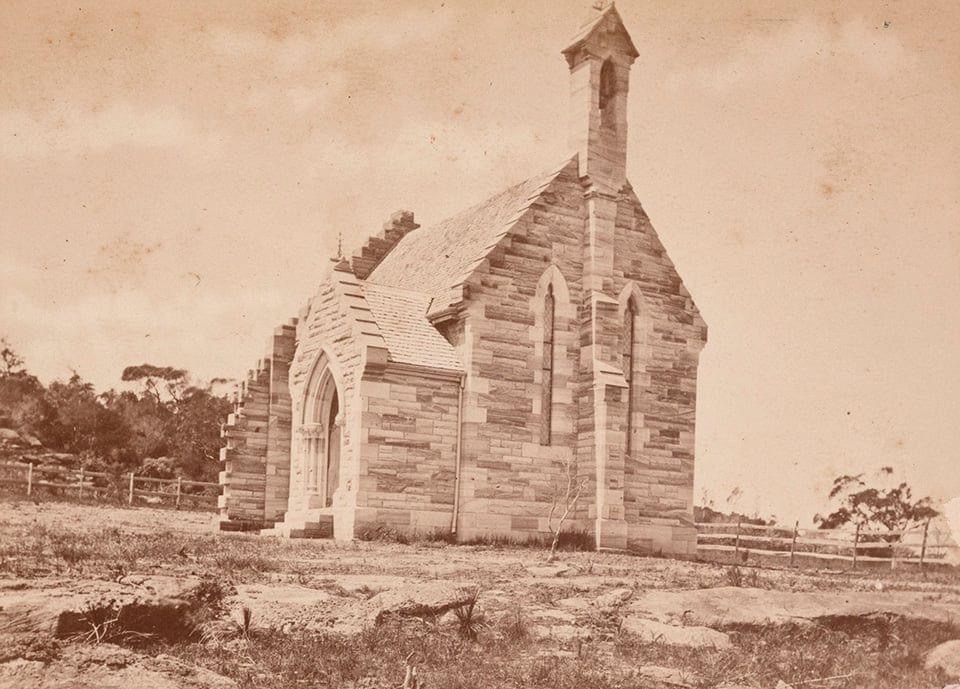
Up on Vaucluse Road, corner of Gilliver Avenue, St Michael’s sits like a sandstone punctuation mark in the eastern-suburbs skyline — tower and spire catching the light when you come over from Rose Bay. Edmund Blacket designed the original Gothic chapel; the foundation stone went down on 29 October 1875 and the little church opened on 17 February 1877. It was a small local building for a still-thin Vaucluse congregation, not the full silhouette you see from the street today.

As the eastern suburbs filled in, the fabric grew in stages. Cyril Blacket — Edmund’s son — worked on early-twentieth-century extensions that added transept, choir and sanctuary space. Then, in the late 1920s–1930s, Professor Leslie Wilkinson finished the west end, baptistery, tower and spire, and designed the parish hall (opened 1929). Wilkinson’s sensitive completion of Blacket’s core won the Sulman Medal for architecture. St Michaels became a full parish in 1913 and remains a landmark of the South Head Anglican parish.

So the familiar towered outline is largely Wilkinson’s finishing campaign on Blacket’s sandstone heart — associated with Blacket, yes, but completed as the skyline piece you recognise today.