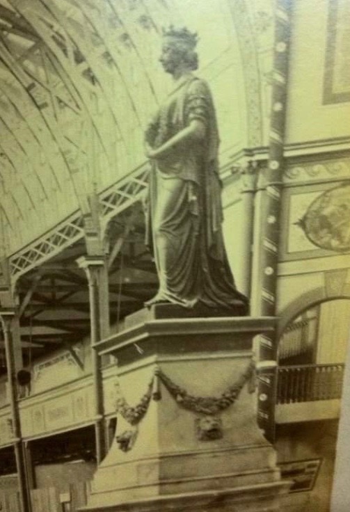
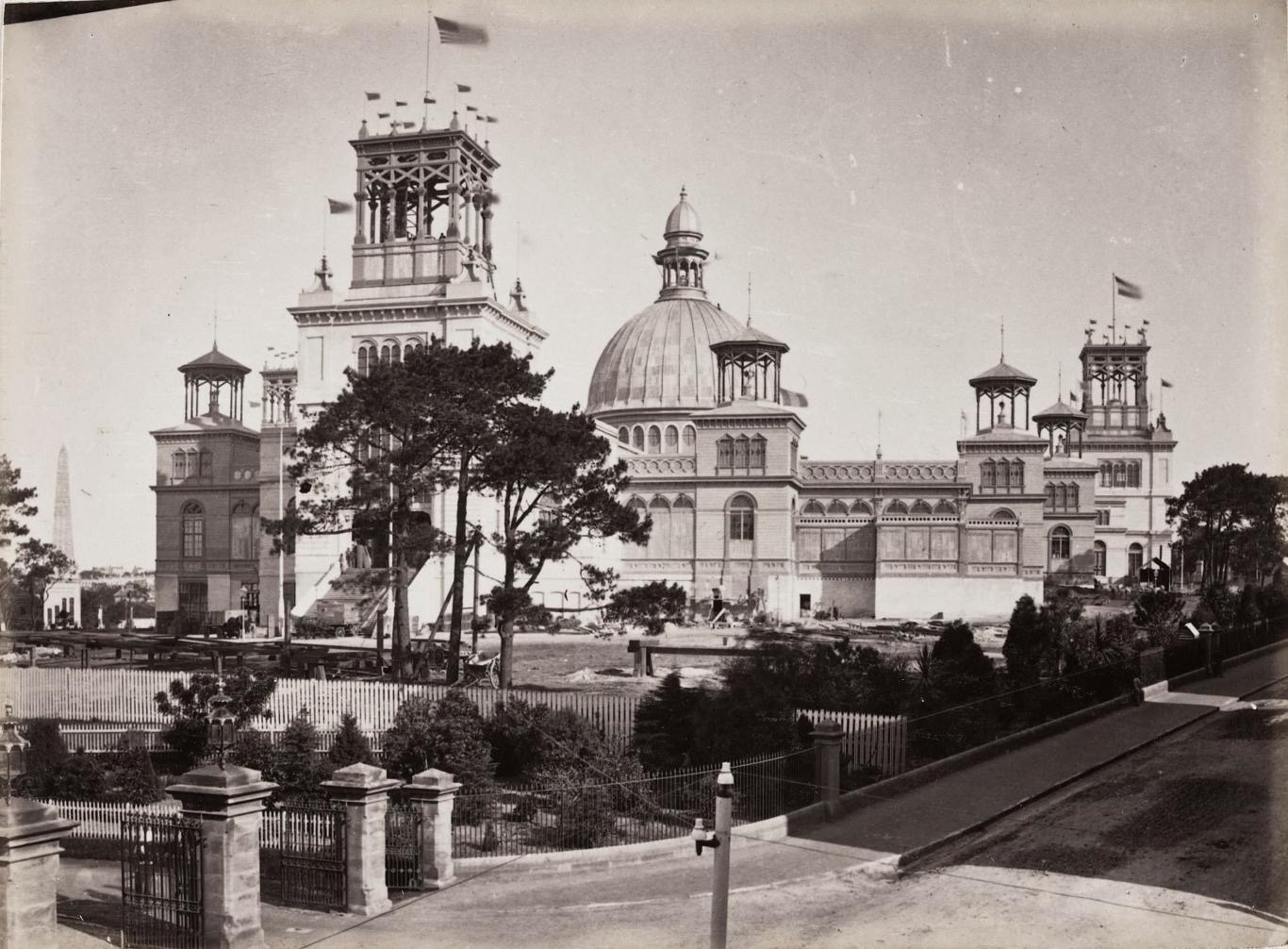
The Sydney Garden Palace In Pictures

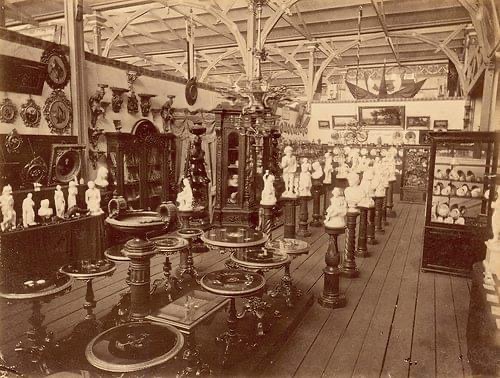
The thing I find Most intriguing..... Yet Disturbing... Is that The Grandeur Of This Building & It's Significance Has Fallen Out Of The Consciousness Of SydneySiders So Quickly. Ask Any School Student Today - What Was The Garden Palace???? And They'd Look At You Blankly

Some More Facts You'll Probably Find Tedious...
It Used 325km Of Sash Bars To Support The Glass Which Weighed More Than 406 Tons
There 3230 Hollow Cast Iron Columns Which Were Primary Supports.... Also Served As Water Pipes To Carry The Rainwater Off The Roof...
From The 54.7km Of Guttering... ((The Desalination Plant Would Never Have Been Built! That Would Collect A Hell Of A Lot Of Water!!!!))
The Central Dome Or Transept Was 22 Metres Wide And Rose 32.9 Metres From The Ground...... Specially Designed To House A Grove Of Elm Trees That Public Opinion. of The Time Would Not Allow To Be Cut Down ((WOW!!!!))

Just A Reminder That The Building Was
800 Feet Long
500 Feet Broad
Covered 5 1/4 Acres
Had 8 & 1/2 Acres Floorspace
Was Built In 8 Months 24/7
Used 2 & 1/2 Million Bricks
Used 4 & 1/2 Million Feet Of Timber
And 250 Ton of Corrugated Galvonized Iron.
THAT IS SO HUGE ITS INCOMPREHNSIBLE IN THIS DAY AND AGE. NO BUILDING WILL EVER BE BUILT LIKE THAT IN THIS COUNTRY AGAIN


I can't Even Comprehend The Sheer Size Of This Building Even Though I Have Studied Many Old Photos Intently.


It Far Outweighs The Queen Victoria Building And Other Significant Buildings Of That Era In Sheer Size, Grandeur And Victorian Extravagance


Some More Facts You'll Probably Find Tedious...
It Used 325km Of Sash Bars To Support The Glass Which Weighed More Than 406 Tons
There 3230 Hollow Cast Iron Columns Which Were Primary Supports.... Also Served As Water Pipes To Carry The Rainwater Off The Roof...
From The 54.7km Of Guttering... ((The Desalination Plant Would Never Have Been Built! That Would Collect A Hell Of A Lot Of Water!!!!))
The Central Dome Or Transept Was 22 Metres Wide And Rose 32.9 Metres From The Ground...... Specially Designed To House A Grove Of Elm Trees That Public Opinion. of The Time Would Not Allow To Be Cut Down ((WOW!!!!))


6 Million People Went Through The Exhibition In 141 Days.... Which Again Is Unimaginable When You Think There a Were No Planes... No Coach Tours.... No Motor Vehicles..... & The Population Was SomMuch Lower Than Today....
Just About Every Man... Woman. And Child Came To See The Exhibition


Over 3,000 Labourers Were Employed To Build The Palace In 8 Months.
It Was The Morning Of September 22nd, 1882..... That it Burnt To The Ground. The Heat Was So Intense.... The Windows In Macquarie Street Cracked

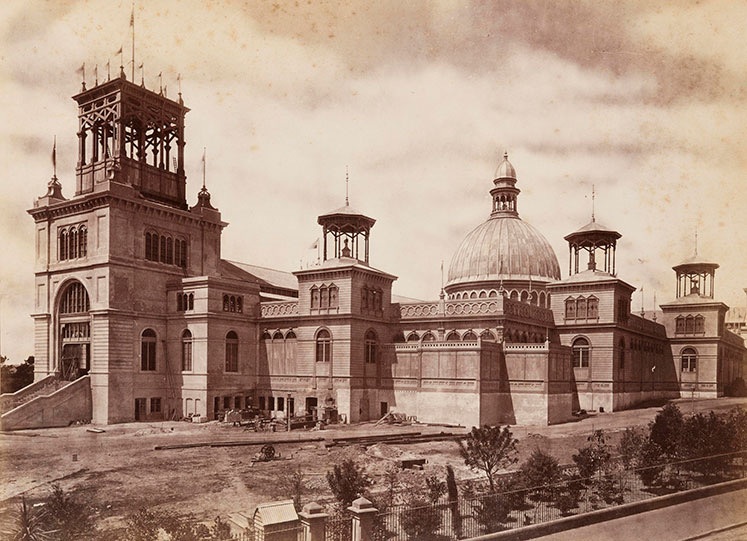


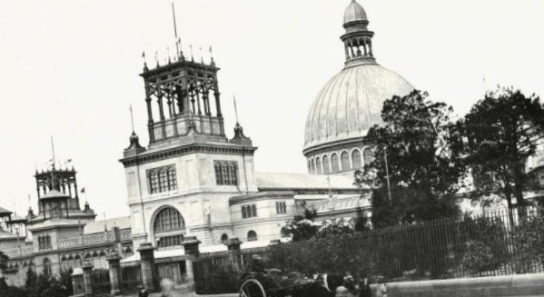


The First Line For A Steam Tram Was Built.... And The Rest Was History Until It Was All Dismantled In The 1960's
The Palace Was Offically Finished A Week Before The Start Of The International Exhibition. If the Palace Was There Today Sydney Soukd Be. A Very Different International City.
There would Be No Toasters.....
Fort Macquarie Would Have Probably Been The Foundation To Be the Opera House.
The Royal Sydney Exchange And Other Elaborate orate Buildings Of That Era Would Be Pride Of Place In This City. There Would Be More Open Spaces As Governors Arthur Phillip And Governor Macquarie Would've Liked. So Many Things Would Be Different. The Coastline And Foreshore Would More Than Likely Be Kept As Public Land Right The Way To South Head I would Say... Apart From Grand Places Like Elizabeth Bay House, Lindesay And Vaucluse House. That's Only. A Guess Though