


History Of Covict Colonial Settlement From the Beginnings Of The First Fleet In 1788 And Other Significant Parts Of "Old Sydney Town's" Heritage


The history of the Lands Department building on Bridge Street in Sydney is closely tied to the development of New South Wales and its colonial administration. The Lands Department, responsible for managing and regulating land ownership, allocation, and transactions, played a crucial role in the expansion and development of the colony. Here's a brief overview of the history of the Lands Department building:
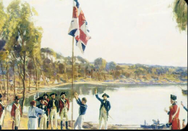
Early History and Development: The origins of the Lands Department can be traced back to the early days of European settlement in Australia. As the colony of New South Wales began to establish itself, the need for a structured system of land management became evident. In 1788, Governor Arthur Phillip arrived with instructions to allocate land to settlers and convicts, which marked the beginning of land ownership in the colony.
Establishment of the Lands Department: The formal establishment of the Lands Department took place in 1833, when the Colonial Secretary's Office was reorganized to create separate departments, including the Surveyor-General's Office and the Registrar-General's Office. These offices were responsible for managing land surveys, land sales, and land title registration.
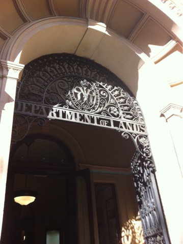
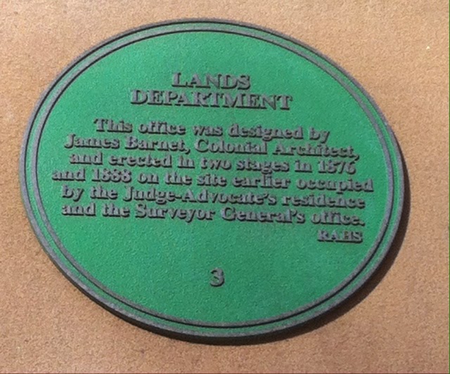
Construction of the Lands Department Building: The Lands Department Building, located at 22-33 Bridge Street in Sydney, was constructed to accommodate the growing administrative needs of the Lands Department. The original section of the building, known as the "Registry Building," was completed in 1877. The building was designed in the Renaissance Revival architectural style and featured ornate detailing, including elaborate facades and decorative elements.
Role in Land Management: The Lands Department played a pivotal role in managing the allocation and ownership of land in New South Wales. This included conducting surveys, maintaining land records, managing land sales, and overseeing the process of granting land titles. The department's activities were essential for facilitating settlement, supporting agriculture, and driving economic development in the colony.
Modernization and Changes: Over the years, the Lands Department underwent modernization and changes in its organizational structure. Advances in technology, such as computerization and digital record-keeping, transformed the way land transactions and records were managed. The department's responsibilities expanded to include environmental and heritage management.
Heritage Significance: The Lands Department building on Bridge Street is of historical and architectural significance. Its ornate design and prominent location reflect the importance of the department's role in the development of New South Wales. The building is a testament to the colonial administration's efforts to establish an organized system of land management.
As of my last update in September 2021, the Lands Department building was repurposed for different uses, including housing various government offices. For the most up-to-date information about the building's current status and any developments that have occurred after 2021, I recommend checking with local historical sources, government websites, or relevant authorities in New South Wales.


